
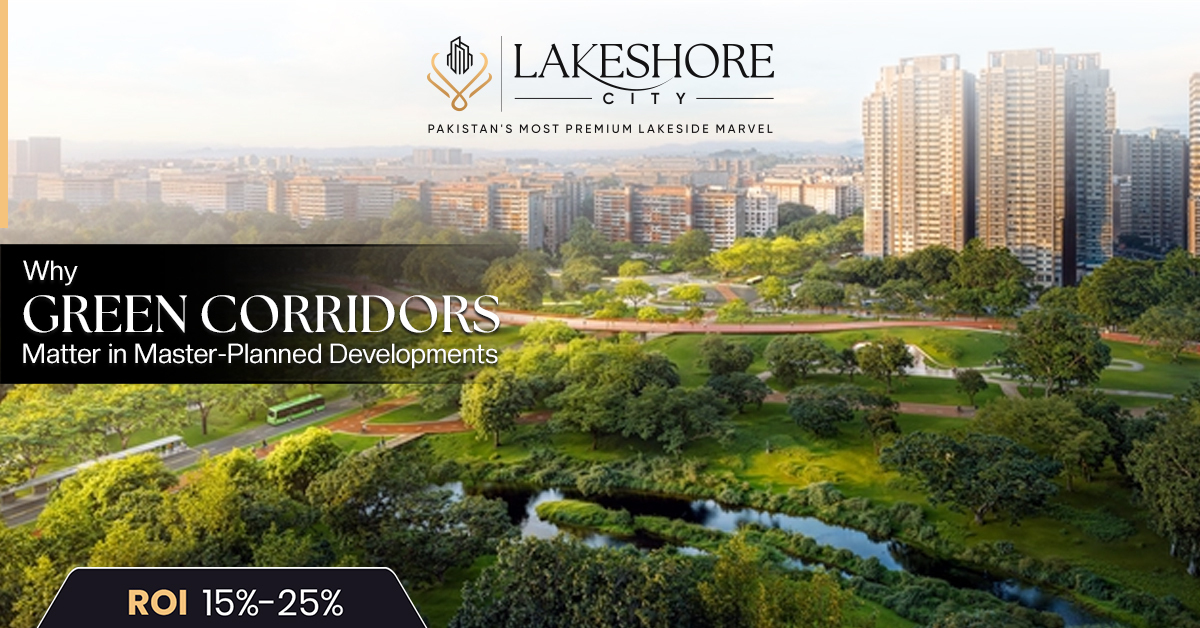
Walk through any well-regarded planned community and you’ll notice something before you notice the houses: a tree-lined path, a stretch of open lawn connecting two neighborhoods, a jogging trail that never quite dead-ends. That connective green tissue isn’t decoration left over after the roads and plots were drawn — it’s usually one of the first decisions a master planner makes.
Green corridors have become a defining feature of serious master-planned communities, in Pakistan and elsewhere. For homebuyers and investors evaluating a project, understanding what these corridors are, and why their presence or absence matters, is a useful filter for judging long-term livability.
What Is a Green Corridor?
A green corridor is a continuous stretch of vegetated, walkable land that links different parts of a development, rather than sitting isolated as a single park. Instead of one green patch in a far corner of a masterplan, a corridor threads through residential blocks, connecting homes to amenities, schools, and recreational zones along a continuous route.
A corridor does three jobs at once: it moves people along walking and cycling paths, moves water through drainage softened with planting, and moves air and shade through continuous tree canopy. A single row of street trees isn’t a corridor — a planned, connected network linking multiple zones of a community is.
Why Green Corridors Matter in Master-Planned Communities
The importance of green corridors in residential developments comes down to how a community functions once people move in, not just how it photographs at launch.
A masterplan without connective green space tends to produce isolated pockets — a cluster of homes here, an amenity block there, linked only by roads. Green corridors change that pattern, giving residents a route to move through the community on foot for short trips. That supports the everyday interaction — neighbors passing on a walk, children playing along a shared path — that makes a development feel like a community rather than a collection of plots.
In sustainable master-planned communities, corridors also do quieter environmental work: absorbing rainwater instead of pushing it into stormwater drains, softening surface heat, and preserving ecological continuity in areas that would otherwise be fully paved.
Green Corridors and the Resident Experience
For residents, green corridors show up in a handful of concrete ways:
- Walkability. Shaded, connected paths make walking to a clubhouse, school gate, or neighbor’s house realistic rather than a last resort.
- Recreation. Corridors double as informal recreation space for jogging or cycling, without a drive to a dedicated park.
- Aesthetics. Continuous greenery reads differently from isolated landscaping around a few show homes; it signals a masterplan designed as a whole.
- Community interaction. Shared walking routes create the low-stakes, repeated contact between neighbors that formal events rarely replicate.
- Quality of life. Shade and lower ambient heat make daily life noticeably more comfortable, particularly in warmer months.
These are the difference between a development residents enjoy living in and one they simply commute out of.
The Role of Green Infrastructure
Green infrastructure in housing developments covers how a masterplan handles water, heat, and open space as a connected system rather than as afterthoughts: landscaped retention ponds, tree-lined drainage channels, and shaded pedestrian networks. Modern master-planned community design increasingly treats this as core infrastructure, planned alongside roads and utilities rather than added once construction is underway. A corridor retrofitted after plots are finalized rarely connects anything meaningfully.
What Homebuyers and Investors Should Look For
Not every development that advertises “green spaces” has actually planned for connectivity. Worth checking directly with the developer:
- Whether green spaces are shown as a connected network on the masterplan, or as isolated patches
- Who maintains green and recreational areas long-term after handover
- How corridors relate to walkable access points — schools, clubs, and residential blocks
- Whether surrounding road and utility infrastructure is actually built, or still at planning stage
- What the current, written payment plan and possession timeline look like, rather than launch-stage promises
A well-planned green corridor on a masterplan that never gets built out is still just a drawing.
How Lakeshore City Fits Into Modern Community Planning
Lakeshore City is positioned as a master-planned lakeside development near Khanpur Dam on the Taxila-Haripur GT Road, roughly a fifteen-minute drive from Islamabad’s D-12 sector. The layout brings together waterfront and hill-view residential plots, dedicated farmhouse zones, and a recreation-anchored club facility, a mix that reflects the kind of land-use thinking that supports walkable, connected communities over a flat, undifferentiated grid.
Lakeshore Residencia, the residential block within the development, offers plot sizes from 5 Marla through 1 Kanal alongside apartment options, set around the project’s lakeside and recreational setting. Lakeshore Club adds a shared recreational anchor — boating, event space, and membership access — giving residents a reason to use shared, walkable areas rather than treating the development purely as a place to sleep.
Access via the Taxila-Haripur GT Road and proximity to the M2 Motorway and Rawalpindi Ring Road are worth reviewing directly for anyone weighing how infrastructure shapes a masterplan’s long-term connectivity.
Final Thoughts
Green corridors signal whether a master-planned community was designed as a connected whole or assembled as disconnected sections. They affect walkability, recreation, resale appeal, and day-to-day comfort in ways that are easy to underrate on a brochure and obvious once you’re living there.
If you’re evaluating Lakeshore City as part of that decision, the current payment plan is a reasonable starting point for the numbers. From there, register your interest to get current details from the sales team, or move ahead by completing the client booking form once you’re ready to formalize a plot.
Frequently Asked Questions
What is a green corridor in a master-planned development?
A green corridor is a connected stretch of vegetated, walkable land — paths, tree cover, and landscaped drainage — that links different zones of a community, rather than a single isolated park.
Why do green corridors matter for property value?
Connected green space improves walkability, comfort, and community feel, all of which tend to support resale appeal and buyer interest over time, though no green feature guarantees appreciation on its own.
Are green corridors the same as parks?
Not exactly. A park is typically a single defined area, while a green corridor is a continuous network that connects multiple parts of a masterplan, often combining walking paths, drainage, and shaded tree cover.
What should I check before assuming a development has real green infrastructure?
Ask whether green spaces are shown as a connected network on the actual masterplan, who maintains them after handover, and whether the surrounding infrastructure is built or still planned.
Does Lakeshore City include green corridor planning?
Lakeshore City’s masterplan combines waterfront and hill-view residential plots, farmhouse zones, and a recreation-anchored club facility. Buyers evaluating the project’s connectivity and green space design should confirm current masterplan details directly with the sales team.